Antarctica maps, plus coloring pages & clipart printables

Antarctica maps, plus coloring pages and printables at PrintColorFun com
Note: This article may feature affiliate links, and purchases made may earn us a commission at no extra cost to you. Find out more here.

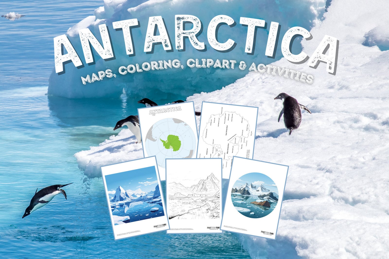
Ever wanted to know about one of the most distant lands on our planet? Here are a few Antarctica maps, along with some coloring pages & printables.

Below, you will find a blank outline, one showing place names, another with the land claims from various nations, and the last showing the area’s position on our globe.

An emperor penguin in Antarctica via NSF
An emperor penguin (Aptenodytes forsteri) walks in the direction of Mount Erebus, an active volcano on Ross Island. Emperors are the largest of all penguin species. These flightless animals live on the Antarctic ice and in the frigid surrounding waters. (Photo Credit: Laura Gerwin via the National Science Foundation)

Fast facts & polar trivia

  • Antarctica is Earth’s southernmost continent, but is not a country.
  • It is mostly uninhabitable, with no indigenous inhabitants, no economy, and no agriculture.
  • The only people who live there (part-time) are researchers. Depending on the weather, there are between 1,000 and 6,000 of them at any given time (including those onboard ships).
  • Antarctica is about 8.82 million square miles in size.
  • 98% percent of the continent is covered with a thick ice sheet, and just 2% of the area is rock.
  • It is the coldest, windiest, and driest continent on Earth, which is why it’s called a polar desert.
  • East Antarctica is a little cooler than West Antarctica (due to higher elevation).
  • The area’s highest point is Vinson Massif, which is 4,892 meters high (16,049 feet).
  • The name “Antarctica” comes from two Greek words meaning “opposite to the Arctic” or “opposite the north.”
  • For researchers to come and go, it has 17 airports (with unpaved runways) and 53 heliports for helicopters.
Antarctica, as it would be seen from space, looking at the bottom of the planet
ALSO SEE THIS:
Penguin clipart & coloring pages: Create a flurry of wintertime fun with 11 crafts & activities

Antarctica map coloring pages & printables

Antarctica map coloring pages and printables (4)

Antarctica map coloring pages and printables (3)

Antarctica map coloring pages and printables (1)

Antarctica map coloring pages and printables (2)


Icy Antarctica coloring pages

Icy Antarctica coloring page from PrintColorFun com (2)

Icy Antarctica coloring page from PrintColorFun com (1)


Antarctica clipart scene backdrop

Antarctica clipart scene backdrop from PrintColorFun com (2)

Antarctica clipart scene backdrop from PrintColorFun com (3)

Antarctica clipart scene backdrop from PrintColorFun com (4)

Antarctica clipart scene backdrop from PrintColorFun com (5)

Antarctica clipart scene backdrop from PrintColorFun com (6)

Antarctica clipart scene backdrop from PrintColorFun com (1)

Pinterest
Facebook
Twitter
Email
Pocket

You might also like these...